

Chapada Diamantina’s headline attractions are Cachoeira da Fumaça, one of Brazil’s tallest waterfalls; the underground light pools of Poço Encantado and Poço Azul; the tabletop Morro do Pai Inácio; and the Vale do Pati, widely rated the country’s finest multi-day trek. The national park is free to enter, has no visitor centre and no gates, and only recommends guides — while almost every attraction with a ticket booth sits outside its boundary.
That last point is the single most useful thing to understand before you go, and almost nothing written about the Chapada explains it. The confusion over prices, permits and guides that fills forums is not confusion at all: it is three different authorities, and it depends entirely on which line you have crossed.
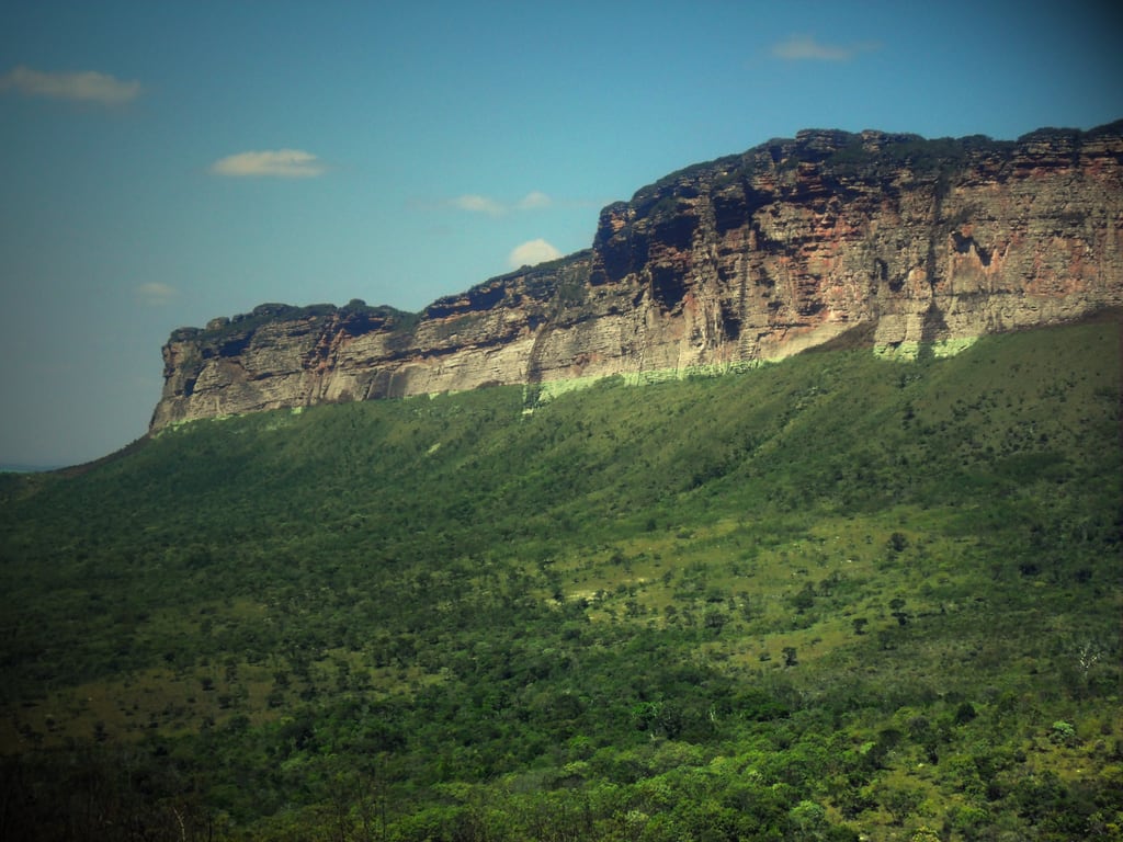
The region sits in the heart of Bahia, about 410 kilometres inland from Salvador — the Bahian prolongation of the Espinhaço range, and home to Pico do Barbado at 2,033 metres, the highest point in northeastern Brazil.
1. The Park Is Only Part of the Story
The Parque Nacional da Chapada Diamantina was created by decree on 17 September 1985 to protect a sample of the Serra do Sincorá — and, unusually, its founding text names the preservation of sites of historic and cultural interest alongside the ecosystems. The diamond heritage is written into the park’s own charter. It covers about 152,142 hectares, roughly 1,520 square kilometres.
But the plateau people mean when they say “Chapada Diamantina” runs to some 38,000 square kilometres, about fifteen per cent of Bahia. The national park is roughly four per cent of it. Land left outside the federal perimeter was picked up in 1993 by a state protected area, the APA Marimbus-Iraquara, covering a further 125,400 hectares and created explicitly to protect what the park had excluded — the Marimbus wetland, the limestone caves around Iraquara, and the morros.
What is inside, and what is not
| Attraction | Which authority |
| Cachoeira da Fumaça, Vale do Pati | Inside the national park — free, unstaffed, guide only recommended |
| Morro do Pai Inácio | Municipal park (Palmeiras, created 2015), inside the state APA — ticketed |
| Lapa Doce, Pratinha, Gruta Azul | Private fazendas inside the state APA — ticketed, guide compulsory at Lapa Doce |
| Poço Encantado, Poço Azul | Outside both, in Itaetê and Nova Redenção — ticketed, booked online |
| Cachoeira do Buracão | Municipal park (Ibicoara) — ticketed, guide compulsory |
| Rio Mucugezinho, Ribeirão do Meio | State APA — free public access |
Free to enter — and unstaffed
The park charges nothing. ICMBio states it plainly, and the national fee schedule in force since November 2025 lists park after park without ever naming Chapada Diamantina. The reason is structural rather than generous: there are no guard posts and no visitor centre to charge at.
The same absence has consequences. Around 300 kilometres of trails are described by the park’s own managers as rústicas, with poor or absent waymarking, and there is no mobile signal anywhere inside the park. Guides are legally only recommended — including on the Vale do Pati and the Fumaça — but treat that as a legal technicality rather than travel advice. Where guides genuinely are compulsory, it is a municipal or private rule: Cachoeira do Buracão and the Gruta da Lapa Doce.
Accessibility: The flip side of an unstaffed park is worth stating early: there is no accessible infrastructure inside it at all — no visitor centre, no accessible toilets, no adapted trail. Section 8 sets out what is nonetheless feasible.
2. Diamonds, and the Towns They Built
Gold came first, in 1710, and ran out. The diamonds were found in the 1840s — the first workings at Mucugê in 1844, the Lençóis river diggings in 1845 — and for a generation this remote plateau supplied the world. The region was originally called the Lavras Diamantinas, the diamond workings, which is where the Chapada got its name.
Between 1845 and 1871 Lençóis was the largest diamond producer on earth and the third most important city in Bahia, with a French vice-consulate installed to handle the trade. At its height it held 20,000 people and 3,000 houses, and exported so much that European cutters could not process half of it. Then South African diamonds were found in 1865, the international market turned in 1871, and it was over.
One local detail is hard to beat: the carbonado, the black industrial diamond, was thrown away here as worthless ferrujão until 1870, when a use was found for it. The largest diamond ever recovered anywhere — the Carbonado Sérgio, 3,167 carats — came out of the ground ten kilometres from Lençóis.
Lençóis
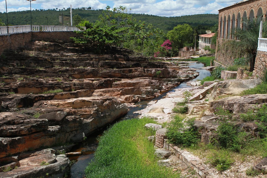
A town of around 10,800 people and the region’s natural base, with the airport, the widest choice of guides and beds, and day trips in every direction. Its architectural and landscape ensemble was listed by IPHAN in 1973 and covers 570 protected properties — mid-to-late-nineteenth-century houses and sobrados in adobe, stone and taipa, painted in strong colours.
Igatu
A district of Andaraí with about 380 residents, most of them descendants of the garimpo, living among the stone ruins of a settlement that once held nine thousand. The houses were built dry-stone, without mortar, which is why it is called the Machu Picchu Baiana. IPHAN listed it in 2000 and calls it a living museum of Brazilian diamond mining. It is also one of the Northeast’s best bouldering sites.
Mucugê
Higher and cooler at around 980 metres, and home to the extraordinary Cemitério de Santa Isabel — white mausoleums built as miniature churches against the bare rock of the Sincorá, begun in 1854 and finished in 1886 during an epidemic. The Byzantine styling is attributed to Turkish-origin diamond buyers. IPHAN’s 1980 listing singles the cemetery out by name.
3. Cachoeira da Fumaça
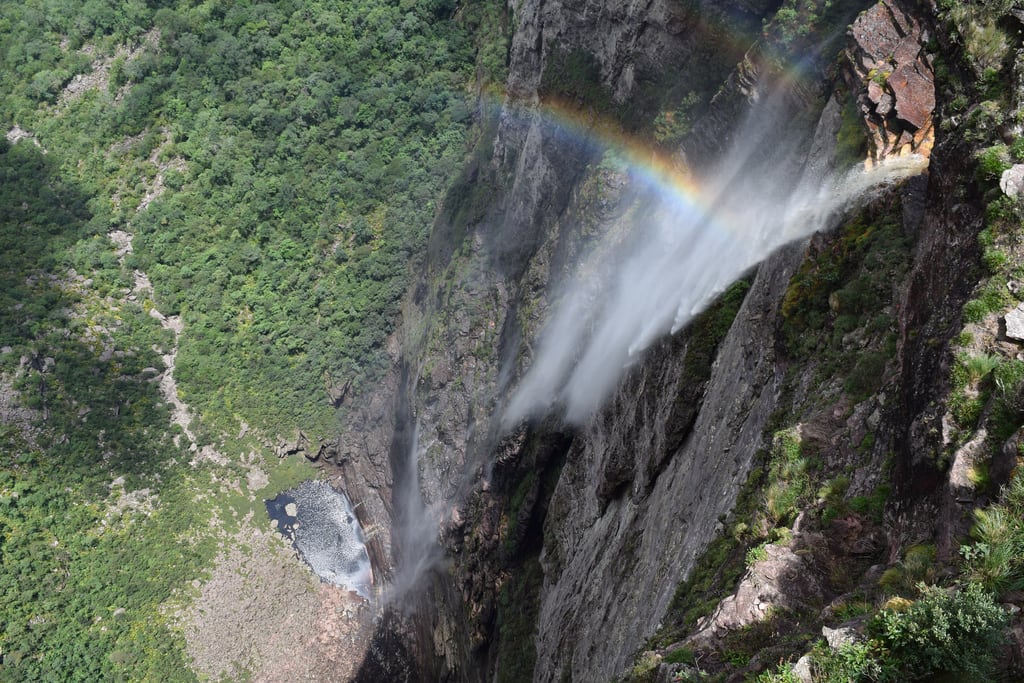
The smoke waterfall, so called because the drop is long enough that the water disperses into mist before it reaches the ground. It is inside the park, at the head of the Vale do Capão in Palmeiras municipality.
On its height, be careful what you repeat. The widely quoted 340 metres traces back to a travel blog. The park authority gives about 380 metres from the lip, with points measuring up to 420 metres from top to pool; the geological survey puts the free fall at around 400 metres. Anything in the 380–400 range is defensible; 340 is not.
From above
The standard visit starts from the village of Campos in the Vale do Capão: roughly five kilometres and about two hours, of which around an hour is steep climbing. It ends at the lip, looking down. There is no swimming anywhere on the route — it is a viewpoint walk, and the park says so.
From below
Reaching the plunge pool is not a day trip. The park documents it as a three-day, two-night traverse of about 25 kilometres between Vale do Capão and Lençóis, sleeping in rock shelters, with the pool itself reached on an out-and-back side trail. Operators quote longer distances for the same route; the park manages the land and itemises the segments, so its figure is the one to trust.
4. The Two Light Pools
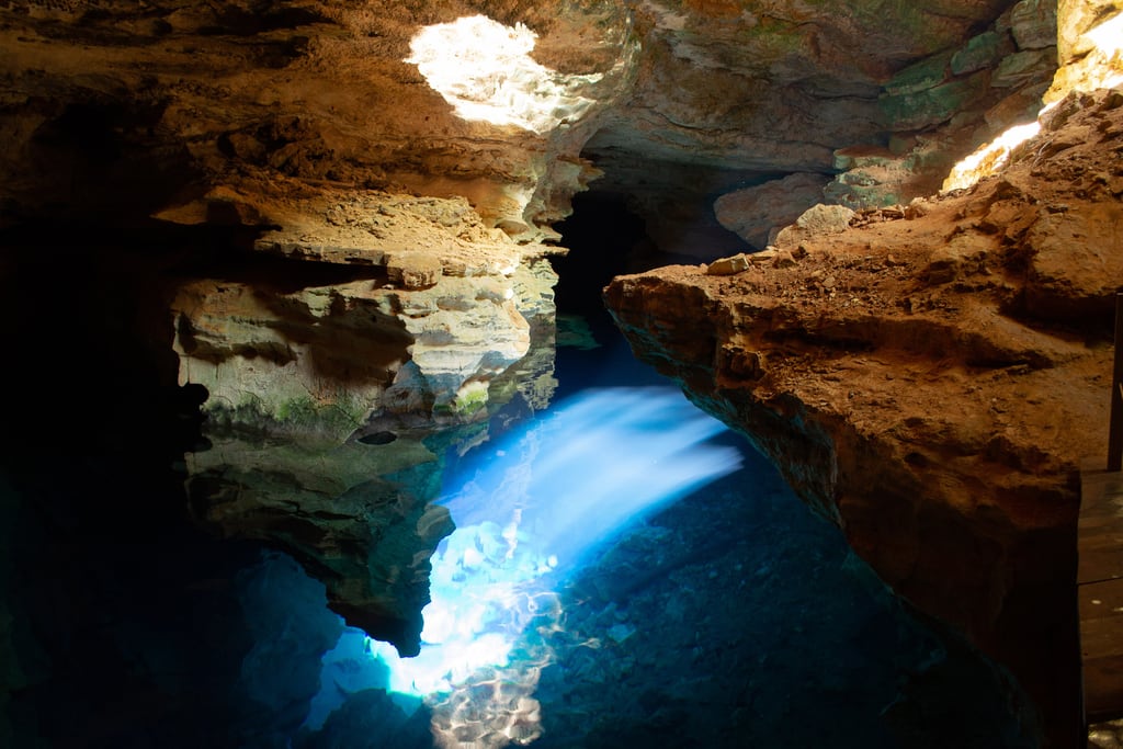
Both are flooded caves where, for part of the year, a shaft of sunlight enters and turns the water an improbable blue. They are constantly confused with one another and they are not the same experience — the difference that matters is that you can swim in one and not the other.
| Poço Encantado | Poço Azul | |
| Where | Itaetê | Nova Redenção |
| Light season | April to September, best around the winter solstice | Roughly 25 February to 25 October, early afternoon |
| Swimming | Not permitted — the water does not circulate, so sunscreen and cosmetics would accumulate | Permitted, with life jacket, mask and snorkel provided |
| Getting in | About 320 steps down into a doline roughly 120 m across, then 150 m inside the cave | A staircase of about 105 steps over some 60 m |
| Rules | Minimum age 12; stays capped at about 15 minutes | Compulsory shower before entry — hair wash included; groups capped at 14 |
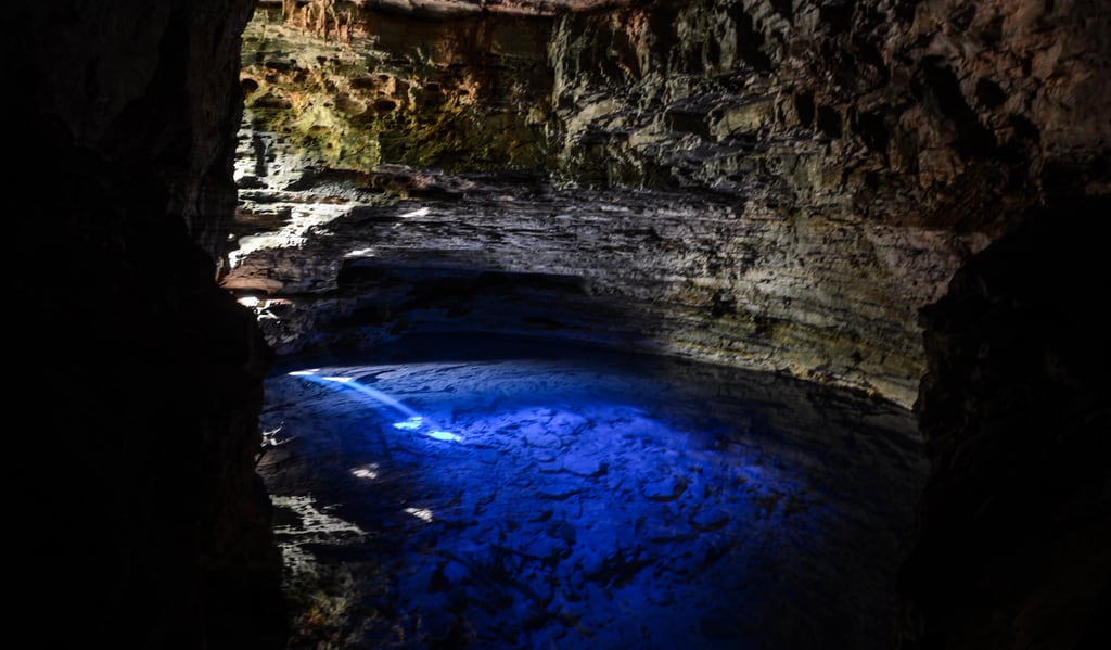
Poço Encantado has a superlative worth knowing: its main chamber, the Salão do Lago, is the largest underground chamber in Brazil by volume, at around 320,000 cubic metres. The water is over sixty metres deep and holds an endemic blind catfish found nowhere else. At the summer solstice the same shaft effect happens by moonlight, in silver rather than blue.
Poço Azul gave up a complete fossil Megatherium — a giant ground sloth — recovered from inside the cave. The shower rule there is not fussiness: it exists to strip oils, sweat, sunscreen and deodorant before anyone enters water that barely moves.
5. Morro do Pai Inácio and the BR-242
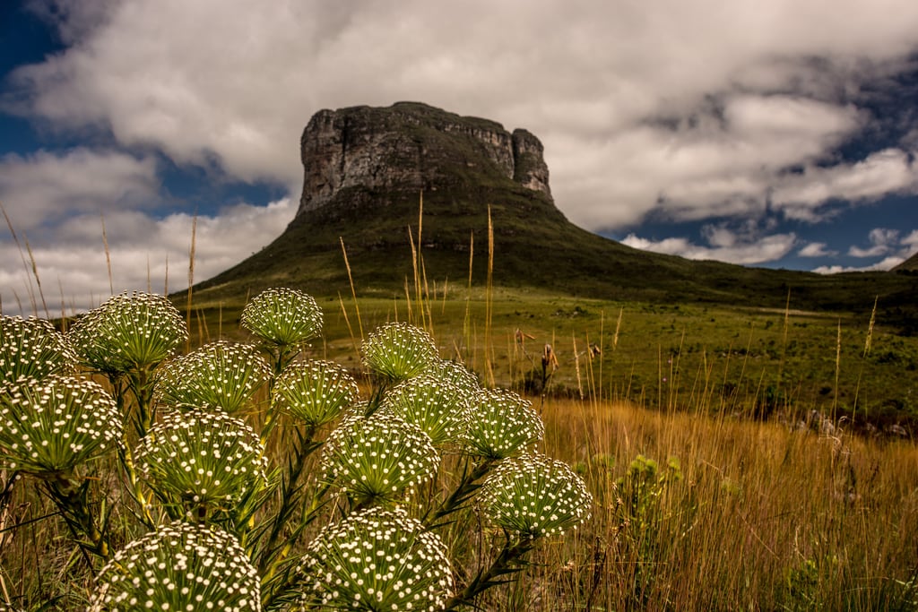
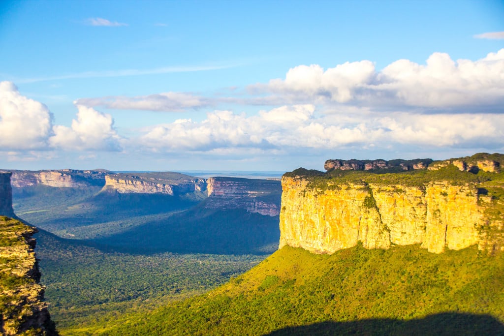
The Chapada’s signature silhouette, a flat-topped remnant standing about 140 metres above the surrounding plain at roughly 1,120 metres above sea level. The climb is short and steep — around 500 metres of trail, twenty to twenty-five minutes — and wooden staircases with handrails were added to the steepest sections in 2018. It is famous for sunset; entry closes at 17:00 but you may stay on for it.
The name comes with a story the geological survey itself records: an enslaved man called Inácio, in love with his master’s daughter, cornered on the summit, is said to have jumped with an open umbrella and got away.
The caves at Iraquara
Gruta da Lapa Doce is the serious one. Lapa Doce II is the fourth-longest surveyed cave in Brazil at about 16.5 kilometres; with Lapa Doce I the system exceeds 25 kilometres. Tours run with a compulsory guide and issued torches, take one to two hours, and start with a 72-metre descent on steps cut into the rock — which you then have to climb back up. The main gallery reaches 60 metres wide and 25 metres high.
Pratinha and Gruta Azul are the gentler pairing, on a single fazenda seventy-odd kilometres from Lençóis. Pratinha is the resurgence of its own river, forming a transparent lake you can snorkel in; Gruta Azul next door is observation only. The property has parking on site, a restaurant, toilets and shops, and the walking involved is minimal.
Free water, no ticket
Two of the best swims cost nothing. The Rio Mucugezinho has a natural rock slide and, downstream beneath a waterfall, the Poço do Diabo, about thirty minutes' walk from the road — access was declared a public right of way after residents blocked an attempt to enclose it in 1995. Ribeirão do Meio, a three-to-four kilometre walk from Lençóis, has a long rock slide into a pool over ten metres deep.
6. Vale do Pati
The Pati is the reason serious walkers come to Brazil. It lies entirely inside the park, covers 12,300 hectares across three municipalities, and was named the country’s best route by the Ministry of Tourism in 2010. It also appears in National Geographic’s Walks of a Lifetime.
| Route | Days | Distance | Notes |
| Guiné → Andaraí | 4 | 30 km | The fastest way in — about three hours from Guiné to the valley floor; exits on the stone-paved Ladeira do Império |
| Vale do Capão → Mucugê | 3 | 40 km | Two descents off the Gerais do Rio Preto: the steep rampa da ruinha or the gentler arrodeio |
| Vale do Capão → Andaraí | 5 | ~60 km | The full traverse |
Sleeping in the valley
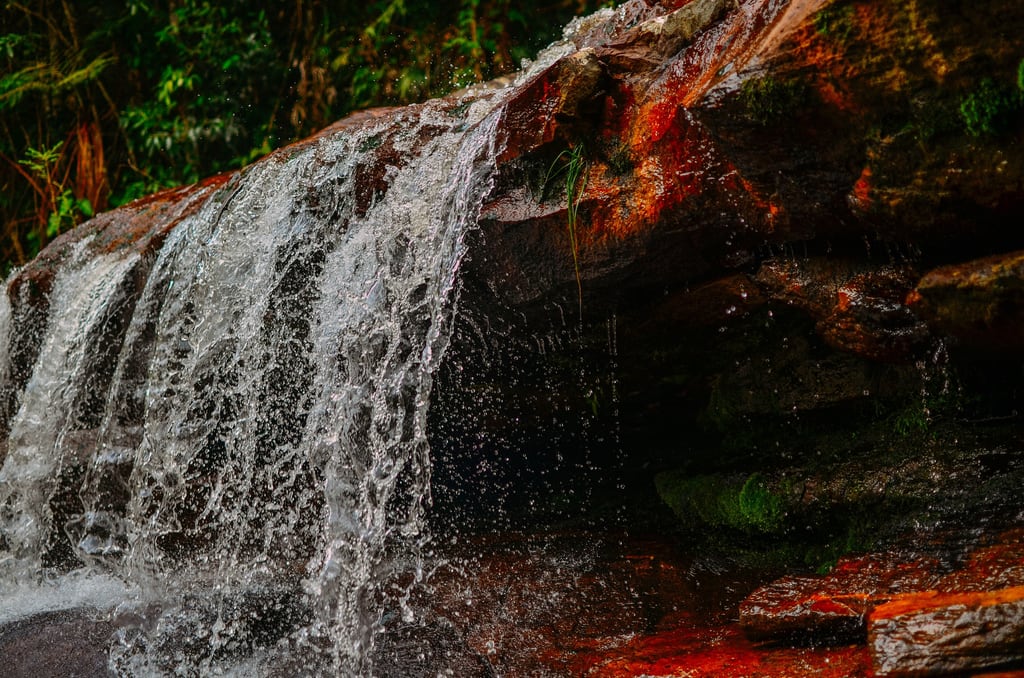
What makes the Pati unlike any other trek in Brazil is that it is inhabited. The valley once held some four hundred families, with its own church and school; around ten patizeiro families remain, supplies still arriving on foot or by pack horse. It is the only place in the national park where you may sleep under a roof rather than in a tent, staying in residents' homes — and those homes are the only places camping is permitted.
Several residents have trained and certified as guides, which is the arrangement to seek out: it puts your money in the valley and gets you a guide who grew up in it.
Accessibility: One current caveat to check before you commit: the trail through the Lapinha cave on the Morro do Castelo has been closed on geological-risk grounds since November 2024, with no reopening date published. Confirm with the park before booking an itinerary that uses it.
7. When to Go, and How Long
The Chapada has a genuine planning conflict, and no guide should pretend otherwise: the season with the best light in the caves is the season with the least water in the waterfalls.
| Season | Months | Rain | What you get |
| Wet | November – March | Peaks in March; November–March carry most of the year’s 1,058 mm | Waterfalls at full volume; muddier trails, river crossings to avoid, cloud that can kill the light beam |
| Shoulder | April and October | Falling or building | The honest compromise — decent flow, and the light season is open at both pools |
| Dry | May – September | Driest in August and September | Reliable sun for the pools and firm trails; some falls run thin or dry out entirely |
Note too that neither pool refunds you for cloud, and that the park warns explicitly against river crossings on rainy days or when water is high — rain moves the riverbeds, so local knowledge of a pool is not knowledge of it after a storm.
How long, and how to get there
Four days is the practical minimum and a week is better; the attractions are scattered across an area the size of a small country, and the Pati alone is three to five days. Lençóis has an airport (LEC) served by Azul, with two flights a week in low season and three in high — a small operation whose schedule genuinely changes, so check rather than assume. By road it is about 410 to 425 kilometres from Salvador, some six hours, and there are daily buses to Lençóis, Palmeiras, Andaraí and Mucugê. Intermunicipal transport between the bases is, in the park’s own word, precário — hire a car if you can.
8. Accessibility: An Honest Assessment
We are an accessible travel operator, so we will say this plainly rather than bury it: Chapada Diamantina is not an accessible destination and should not be sold as one.
The evidence is the government’s own. The park states that there are no institutional visitor structures inside it at all — no gatehouse, no visitor centre — which means no accessible toilets, no accessible parking and no information point. It is absent from every survey of Brazilian conservation units with adapted infrastructure; the parks that appear on those lists are Chapada dos Veadeiros, Serra dos Órgãos, Itatiaia and Tijuca, and we cover them in our guide to accessible national parks in Brazil. A 2021 study published by ICMBio itself found only about a third of the conservation units surveyed had any accessibility initiative at all.
What is nonetheless feasible
- A Julietti all-terrain trail chair can be borrowed free in Lençóis. The single-wheeled chair, from the NGO Montanha para Todos, is pushed and steadied by companions; the public register lists custodians in Lençóis and in the wider Chapada, and there is no charge to use one. Be clear about what it is: it makes a rough trail portable with a team, not independently accessible.
- Cachoeira do Mosquito has a reported wheelchair-accessible upper viewpoint, with vehicle access to the top and no four-wheel drive needed. This rests on a single regional source, so we would have it photographed and measured before promising it — but it is the most promising lead in the region.
- A private roadside viewpoint faces Morro do Pai Inácio from the BR-242, with free parking, giving you the postcard view without the climb. The municipal park at the morro itself gives free entry to people with disabilities.
- Fazenda Pratinha is the best-equipped site in the region — parking on the property, restaurant, toilets, and minimal walking to the lake. No ramp or transfer detail is published, so assume none until confirmed.
- Marimbus, the “Bahian Pantanal”, is boat-borne rather than a walk, reached by vehicle to the quilombola community of Remanso and then by canoe. Boarding a low canoe from a riverbank is the crux, and nobody publishes how it is managed — ask first.
The surfaces, and why they will not change
Accessibility: Lençóis is the harder problem. IPHAN’s own description of the listed centre is of streets whose surface is in places the bare bedrock itself, elsewhere irregular decorative stonework, laid across a slope. Igatu is dry stone built without mortar — a specialist accessible operator uses the Julietti chair to move around it. Heritage protection means neither will be resurfaced. Plan a car-based itinerary with short level approaches, and budget for a companion team.
Frequently Asked Questions About Chapada Diamantina
Do you have to pay to enter Chapada Diamantina National Park?
No. The park is free and has no ticket office, because it has no guard posts or visitor centre. What you pay for are the attractions outside the federal boundary — Morro do Pai Inácio, the caves at Iraquara, Poço Azul, Poço Encantado and Cachoeira do Buracão are variously municipal, private or in the state protected area.
Do you need a guide in Chapada Diamantina?
Legally, not inside the national park — even on the Vale do Pati and Cachoeira da Fumaça, the park only recommends one. Treat that as a technicality: there are around 300 km of rough, poorly marked trails and no mobile signal anywhere in the park. Guides are genuinely compulsory at Cachoeira do Buracão and the Gruta da Lapa Doce, which are municipal and private respectively.
How tall is Cachoeira da Fumaça?
About 380 metres from the lip, with points measuring up to 420 metres from top to pool according to the park authority; the geological survey puts the free fall at around 400 metres. The 340-metre figure that circulates widely traces back to a travel blog and is the least defensible of them.
When is the best time to visit Chapada Diamantina?
It depends what you want. May to September is dry, with reliable sun for the light pools and firm trails, but some waterfalls run thin. November to March fills the waterfalls but brings mud, river crossings and cloud that can kill the light beam. April and October are the genuine compromise.
Is Chapada Diamantina wheelchair accessible?
Largely not, and we would not sell it as such. The national park has no visitor centre, no accessible toilets and no adapted trail, and it does not appear on any list of Brazilian conservation units with accessible infrastructure. What is feasible is a car-based itinerary with short level approaches — a roadside viewpoint, the Fazenda Pratinha lake, the Marimbus canoe, the town centres — supported by a Julietti trail chair, free to borrow in Lençóis, and a companion team.
Conclusion
The Chapada rewards people who understand its structure. A free, unstaffed national park sits at the centre; a ring of municipal parks, private fazendas and a state protected area holds most of what you will actually queue and pay for. Knowing which is which turns a confusing destination into a straightforward one.
Give it a week if you can, four days if you cannot. Come in April or October if you want both water and light. And if the Vale do Pati is the reason you are going, stay in the valley with the families who live there — it is the difference between walking through a landscape and being let into one.
If you would like this planned around specific access needs — which here means honest scoping rather than optimistic booking — get in touch or see our tours. Chapada Diamantina pairs naturally with Salvador, the gateway city four hundred kilometres east, and readers weighing up Brazil’s other great cave-and-water destination should compare our guide to Bonito.
Image credits: Leonardo Gentile, Mikaelli Ernesto, Joedison Rocha (CC BY-SA 4.0); TontiTonti, Jack5599, Leonardobatista, Jeilsonandrade (CC BY-SA 3.0); Turismo Bahia (CC BY-SA 2.0), via Wikimedia Commons.
 English
 Portuguese
  Español
  Français
  Deutsch
  Italiano